

Key Takeaways - Vehicle Trackers Decoded: GPS Magic Made Simple
Vehicle trackers combine GPS satellites, cellular networks, and smart software to pinpoint your vehicle's exact location in real-time.
- GPS satellites communicate with your tracker to calculate precise positioning using triangulation from multiple satellites orbiting Earth.
- Cellular or satellite networks transmit location data from your vehicle to monitoring systems, enabling instant tracking updates.
- Essential components include GPS receivers, communication modules, and power systems that work together seamlessly inside a compact device.
- Business applications range from fleet management to theft recovery with benefits including reduced fuel costs, improved driver safety, and enhanced operational efficiency.
Understanding how vehicle trackers work helps you choose the right tracking solution and maximize its potential for personal or business use.
How GPS Vehicle Tracking Technology Works: The Complete Technical Breakdown
Vehicle tracking systems operate through a three-step technical process that transforms satellite signals into actionable business intelligence. Understanding this process helps you choose the right tracking solution and troubleshoot any issues that arise.
The GPS Satellite Network: How Your Vehicle Connects to Space
Your vehicle tracker receives signals from a network of 24 GPS satellites orbiting Earth at 12,000 miles above the surface. Each satellite broadcasts its exact location and the precise time the signal was sent. The tracking device in your vehicle calculates its position using a process called triangulation.
To determine accurate location, the tracker needs signals from at least four satellites. Three satellites provide latitude, longitude, and altitude, while the fourth corrects for timing errors. This process happens continuously, with most modern trackers updating position data every 10 to 30 seconds depending on your settings.
The GPS receiver in your tracker processes these signals using built-in algorithms that account for atmospheric interference and signal delays. Accuracy typically ranges from 3 to 16 feet under normal conditions, though buildings and weather can affect precision.
Data Transmission Methods: Cellular vs. Satellite Communication
Once your tracker determines its location, it must transmit this data to your monitoring system. Most vehicle trackers use cellular networks because they offer reliable coverage in populated areas and lower operational costs. These devices contain SIM cards that connect to 3G, 4G, or 5G networks to send location updates.
Cellular transmission works well for urban and suburban fleets but can face coverage gaps in remote areas. The data packages are small, typically requiring minimal bandwidth, which keeps monthly communication costs low for fleet managers.
Satellite communication provides an alternative for vehicles operating in remote locations without cellular coverage. While more expensive, satellite transmission ensures global connectivity. Some premium trackers offer dual-mode capability, automatically switching between cellular and satellite based on availability.
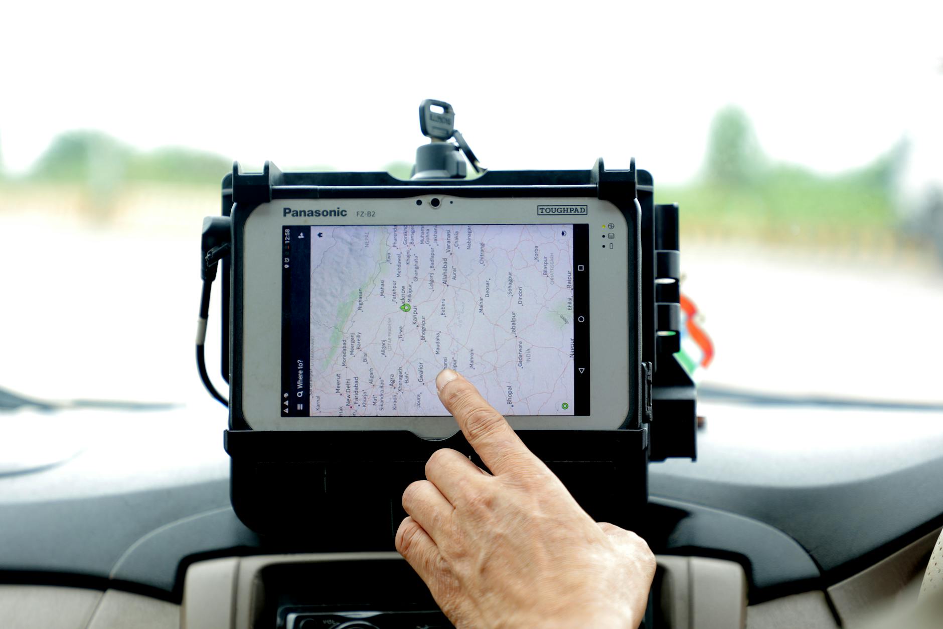
Real-Time Processing: From Signal to Dashboard Analytics
The transmitted location data travels to secure servers where tracking software processes and stores the information. This processing stage transforms raw GPS coordinates into meaningful insights like speed calculations, route analysis, and geofence alerts.
Your fleet management dashboard receives this processed data through internet connections, displaying real-time vehicle locations on digital maps. The system can trigger immediate notifications for events like speeding, unauthorized use, or maintenance reminders based on predefined parameters you set.
Modern tracking platforms use cloud-based processing to handle large amounts of data efficiently. This architecture allows you to access your fleet information from any internet-connected device while maintaining data security through encrypted connections.
The entire process from satellite signal to dashboard display typically takes less than 60 seconds, enabling true real-time fleet monitoring and rapid response to operational changes or emergencies.
GPS vehicle tracking process breakdown: from satellite signals to data transmission
| Process Step | Technology | Requirements | Performance |
|---|---|---|---|
| Signal Reception | GPS Satellites | 24 satellites orbiting | 12,000 miles altitude |
| Position Calculation | Triangulation | 4 satellites minimum | 3-16 feet accuracy |
| Data Updates | Built-in algorithms | Continuous processing | 10-30 second intervals |
| Data Transmission | Cellular networks | Network coverage | Real-time monitoring |
Essential Components of Modern Vehicle Tracking Systems
Understanding the core components of vehicle tracking systems helps you make informed decisions about which solution best fits your personal or fleet tracking needs. Modern systems combine specialized hardware with powerful software platforms to deliver comprehensive vehicle monitoring capabilities.
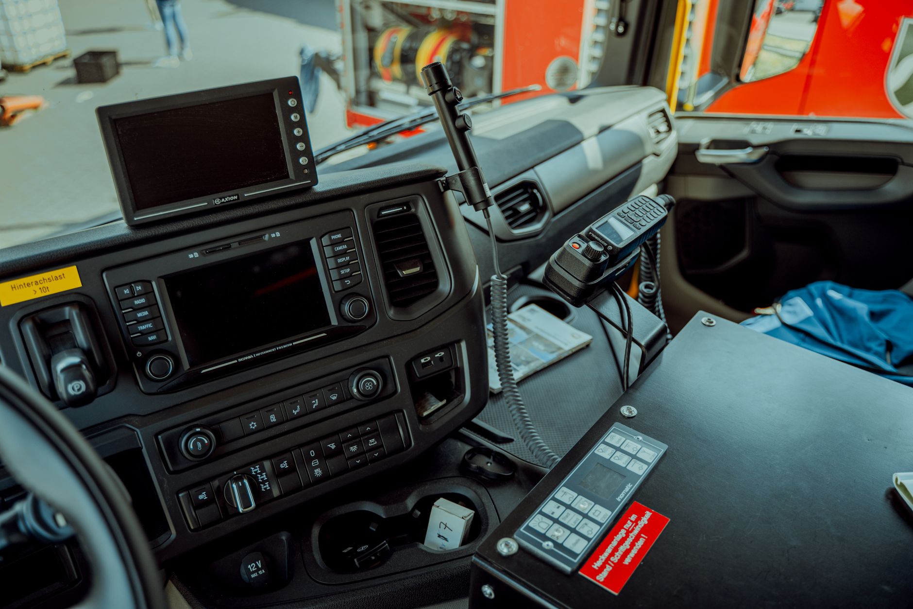
GPS Hardware: OBD Ports, Hardwired Units, and Battery-Powered Options
Vehicle trackers come in three primary hardware configurations, each suited for different applications and installation requirements.
OBD port trackers plug directly into your vehicle's diagnostic port, typically located under the dashboard. These units draw power from the vehicle and offer the simplest installation process, requiring no technical expertise. They provide reliable tracking for most passenger vehicles and light commercial fleets.
Hardwired trackers connect directly to your vehicle's electrical system, offering the most secure and tamper-resistant installation. Professional installation ensures optimal placement and power connection. These units work best for high-value vehicles or fleets requiring maximum security and continuous operation.
Battery-powered trackers operate independently of vehicle power systems, making them ideal for trailers, equipment, or temporary tracking needs. Modern units offer extended battery life ranging from weeks to months, depending on reporting frequency and usage patterns.
Software Platform Features: Mapping, Alerts, and Reporting Capabilities
The software platform transforms raw GPS data into actionable insights for vehicle management and monitoring.
Real-time mapping displays vehicle locations on interactive maps with street-level detail. Advanced platforms offer satellite imagery, traffic overlays, and historical route playback to help you understand vehicle movement patterns and optimize routes.
Alert systems notify you immediately when specific events occur. Common alerts include speeding violations, unauthorized vehicle use, entry or exit from designated areas, and maintenance reminders based on mileage or engine hours.
Reporting capabilities generate detailed analytics on vehicle usage, driver behavior, fuel consumption, and maintenance schedules. These reports help identify cost-saving opportunities and improve operational efficiency across your fleet.
Integration Points: How Trackers Connect with Fleet Management Tools
Modern tracking systems integrate seamlessly with existing business tools through API connections and data exports. Popular integrations include accounting software for mileage tracking, dispatch systems for route optimization, and maintenance platforms for service scheduling.
Cloud-based platforms ensure your tracking data synchronizes across multiple devices and applications, providing consistent information whether you access it from a computer, smartphone, or tablet.
Power Management: Understanding Battery Life and Vehicle Integration
Vehicle-powered units typically include backup batteries that maintain operation for several hours during vehicle downtime. This feature ensures continuous tracking even when the main power source is disconnected.
Standalone battery units optimize power consumption through configurable reporting intervals. Reducing update frequency from every minute to every hour can extend battery life significantly while still providing adequate tracking coverage for most applications.
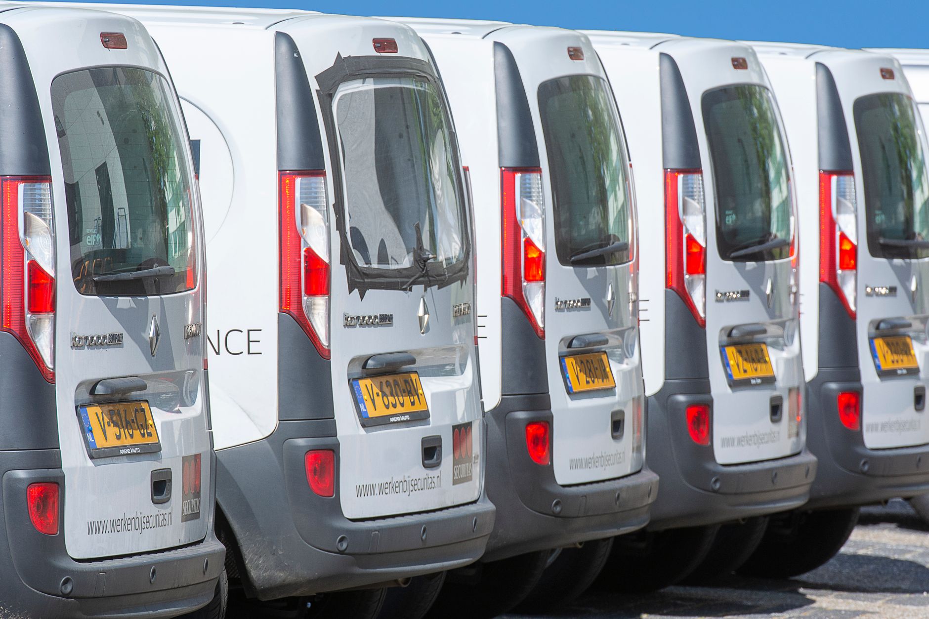
Practical Applications and Business Benefits of Vehicle Tracking
Vehicle tracking technology delivers measurable improvements across fleet operations, transforming raw GPS data into actionable insights that reduce costs and boost efficiency. Modern tracking systems provide fleet managers and individual vehicle owners with powerful tools to optimize operations while protecting valuable assets.
Route Optimization: How GPS Data Reduces Fuel Costs and Delivery Times
GPS tracking systems continuously analyze vehicle routes to identify the most efficient paths between destinations. The technology compares actual routes against optimal alternatives, revealing opportunities for significant cost savings. Fleet managers can reduce fuel consumption by 15-20% on average by implementing GPS-guided route optimization.
Real-time traffic data integration allows dispatchers to reroute vehicles around congestion, accidents, or construction zones. This dynamic routing capability reduces delivery times and improves customer satisfaction. Many fleet operations report cutting average delivery times by 25% after implementing comprehensive GPS tracking solutions.
The system tracks historical route performance, enabling managers to identify patterns and make data-driven decisions about service territories, delivery schedules, and driver assignments. This analytical approach eliminates guesswork and creates consistent operational improvements.
Driver Behavior Monitoring: Speed, Idle Time, and Safety Analytics
Advanced vehicle trackers monitor critical driver behaviors that directly impact operational costs and safety records. The system automatically records speeding incidents, harsh braking events, rapid acceleration, and excessive idling. This comprehensive monitoring creates accountability while identifying training opportunities.
Idle time monitoring proves particularly valuable for cost control, as excessive idling can waste hundreds of gallons of fuel annually per vehicle. GPS trackers alert managers when vehicles idle beyond preset thresholds, enabling immediate corrective action.
Safety analytics help reduce insurance premiums and accident rates. Insurance companies often provide discounts of 5-15% for fleets using GPS monitoring systems, recognizing the proven correlation between tracking technology and improved safety performance. Driver scorecards generated from GPS data create positive competition among team members while highlighting safety achievements.
Theft Prevention and Asset Recovery: Security Features That Protect Your Investment
Vehicle tracking systems provide robust theft protection through multiple security layers. Geofencing technology creates virtual boundaries around authorized areas, triggering instant alerts when vehicles move outside designated zones during off-hours.
The National Insurance Crime Bureau reports that GPS-equipped vehicles have recovery rates exceeding 90%, compared to just 50% for untracked vehicles. This dramatic improvement in recovery odds makes tracking systems essential for protecting valuable fleet assets.
Remote immobilization features allow authorized personnel to disable stolen vehicles safely, preventing further unauthorized use. Combined with silent tracking capabilities, these security features enable law enforcement to recover stolen assets quickly while minimizing damage or additional theft risk.
FAQ - Frequently Asked Questions
How accurate are GPS vehicle trackers for fleet management?
GPS vehicle trackers typically provide accuracy within 3-5 meters under optimal conditions with clear sky visibility. Modern fleet tracking systems can achieve even better precision of 1-3 meters when using advanced GPS chipsets and multiple satellite constellations. Accuracy may decrease in urban areas with tall buildings or under heavy tree cover, but remains sufficient for effective fleet management and route optimization.
What's the difference between active and passive GPS tracking?
Active GPS trackers transmit location data in real-time through cellular networks, allowing immediate monitoring and alerts. Passive GPS trackers store location data internally and require physical retrieval of the device to download the information. Active tracking enables live fleet management and instant notifications, while passive tracking is more cost-effective but only provides historical data after collection.
Can vehicle trackers work without cellular coverage?
GPS vehicle trackers can still receive and record location data without cellular coverage since GPS satellites operate independently of cellular networks. However, they cannot transmit this data in real-time to monitoring systems without cellular or WiFi connectivity. Most trackers store the location data internally and automatically upload it once cellular coverage is restored.
How much data do GPS trackers use per month?
Most GPS vehicle trackers use between 5-20 MB of data per month, depending on reporting frequency and additional features. Basic tracking with updates every few minutes typically consumes 5-10 MB monthly. Trackers with frequent updates, detailed reporting, or additional features like driver behavior monitoring may use 15-30 MB per month.


Dejar un comentario
Este sitio está protegido por hCaptcha y se aplican la Política de privacidad de hCaptcha y los Términos del servicio.